Geological Mapping at Scale 100,000:1 for the North and Center Eastern Desert of Egypt Using Remote Sensing Data.(Hurghada and Gabal Abu DukhanSheets)
Researcher:
Prof. Dr. Mohamed Fouad Sadiq
Summary of project:
The geological map and the precise separation of rock units, their classification, and knowledge of their origin, as well as the geological structures, are considered among the most important factors that help in the search and exploration of mineral resources. During the period from 1992 to 2005, in cooperation with the British Geological Survey (BGS), the Egyptian General Authority for Geological Survey and Mineral Resources (EGSMA), currently the Egyptian General Authority for Mineral Resources (EMRA), implemented the project of geological remapping of the Egyptian Eastern Desert, which resulted in the publication of ten plates. Geological maps (on a scale of 1:250,000) covered the Eastern Desert from Hurghada in the north to the southern borders of Egypt and from the Red Sea in the east to the Nile Valley in the west, in addition to producing two geological maps on a scale of 1:100,000 that covered the Ras Gharib - Ras Bakr area in the northern part of the Eastern Desert. The production of these geological maps relied mainly on field studies and previously prepared geological maps.
One of the main goals of the Petrology and Geological Mapping Department at the National Authority for Remote Sensing and Space Sciences is the preparation of geological maps at different drawing scales for the Egyptian deserts, using various satellite visual data. In this context, the topographic panels of Jebel Abu Dukhan and Hurghada in the northern Eastern Desert of Egypt were chosen as the beginning of this year 2023-2024 for a research plan aimed at preparing geological maps of the Eastern Desert at a scale of 1:100,000. This will be accomplished based on data for interpreting various satellite visuals and map data. previous geological
The objective of the project:
Producing geological maps at a scale of 100,000:1 showing the distribution of rock units and geological structures of the topographic Jebel Abu Dukhan and Hurghada blocks in the northern eastern desert of Egypt using processed satellite visual data and previous geological map data.
The most important outputs:
Producing processed and processed satellite images that cover the study area and reflect the distribution of different rock units.
Producing geological maps at a scale of 100,000:1 showing the distribution of rock units and geological structures using processed satellite visual data.
Producing a database containing data on the geological characteristics of the various rock units, their distribution and classification, in addition to spectral measurements of samples representing these types.
A collection of images that express the outputs
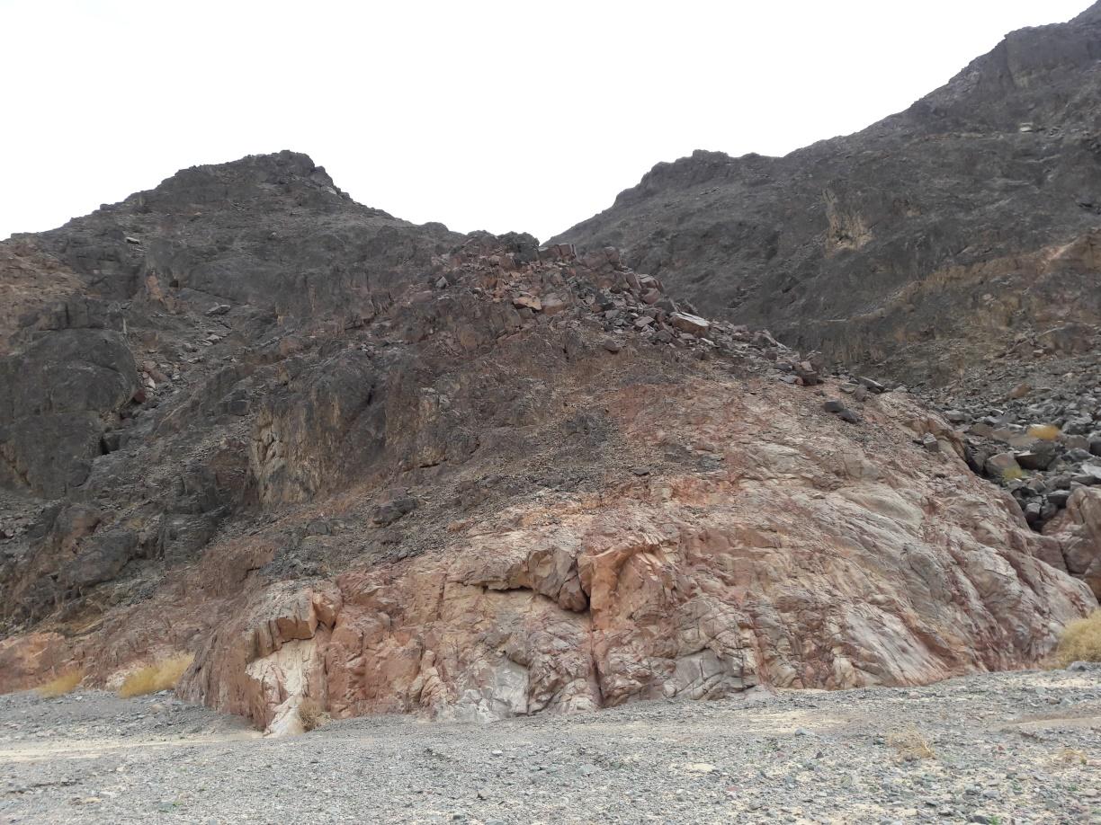
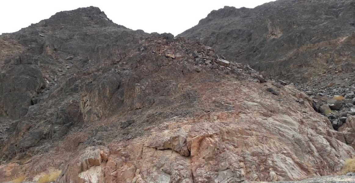
A field photograph of Jabal al-Dukhan in the northern Eastern Desert, Egypt.
An image showing the spectral fingerprint of one of the collected rock types.
Latest Events


Latest News
NARSS
National Authority for Remote Sensing & Space Sciences
NARSS is the pioneering Egyptian institution in the field of satellite remote sensing. NARSS is an outgrowth of a Remote Sensing Center, established in 1971 as an American-Egyptian joint project that was affiliated to the Egyptian Academy of Scientific Research and Technology


