Workshop on “Remote Sensing and Geographic Information Systems in Engineering Fields for Sustainable Development”
Joint cooperation between the Sensors Authority and the Naval Academy.
Launching educational sweeping satellites
Workshop on “Remote Sensing and Geographic Information Systems in Engineering Fields for Sustainable Development”
Dr. confirmed. Ayman Ashour, Minister of Higher Education and Scientific Research, stressed his interest in strengthening the bonds of friendship and cooperation between Arab countries in the educational and research fields, pointing to the important role of the Arab Academy for Science, Technology and Maritime Transport, as one of the higher education institutions established in Egypt, and the educational paths it provides that are characterized by high quality. Where quality and harmonious diversity serve the purposes of development and dynamism in development to keep pace with international changes, the Academy is one of the mechanisms for joint Arab action, and one of the distinguished academic and cultural arms of the League of Arab States, in light of the major transformations that Arab action is witnessing.
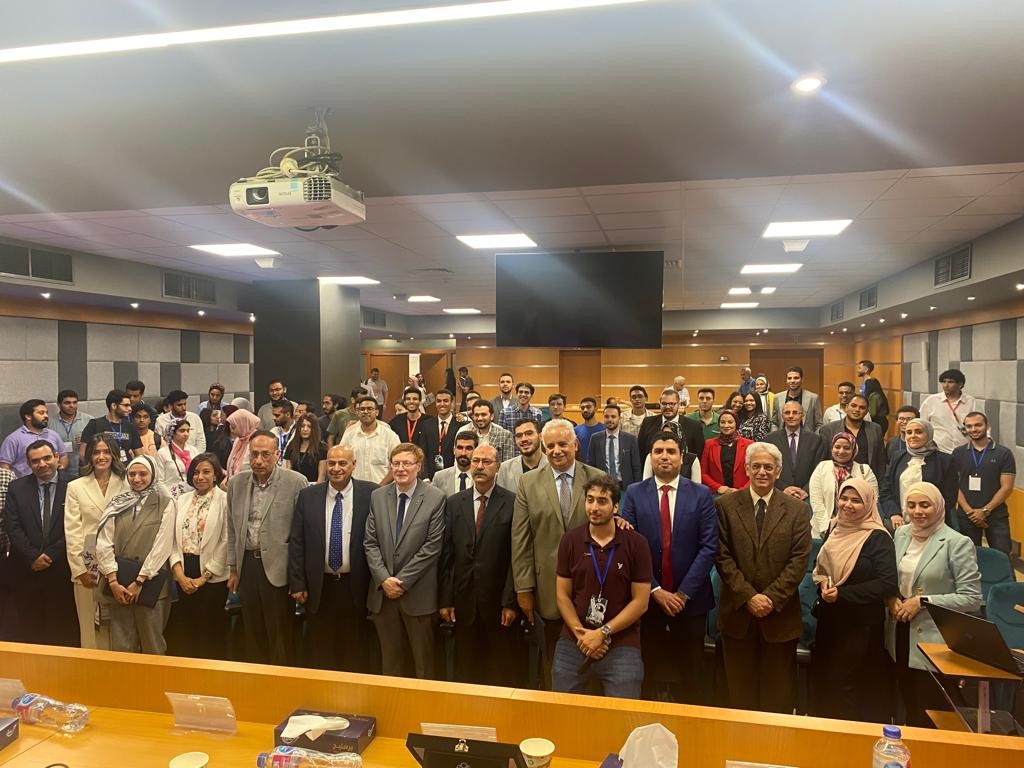
In this context, and under the patronage of Dr. Ayman Ashour, the National Authority for Remote Sensing and Space Sciences, in cooperation with the Arab Academy for Science, Technology and Maritime Transport, held a workshop on “Remote Sensing and Geographic Information Systems in the Engineering Fields for Sustainable Development,” at the Arab Academy’s headquarters.
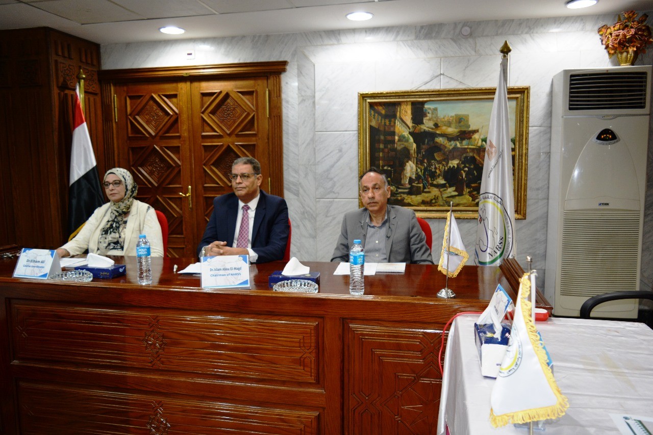
Dr. confirmed. Islam Abu Al-Majd, Chairman of the National Authority for Remote Sensing and Space Sciences, said that this workshop comes within the framework of fruitful cooperation between the Authority and the Arab Academy for Science, Technology and Maritime Transport, pointing to the Authority’s role in spreading awareness and culture of remote sensing technology and space sciences and their applications in Egyptian society.
Dr. noted. Islam said that the symposium discussed the applications of remote sensing and geographic information systems in the fields of engineering to achieve sustainable development, as one of the axes of capacity building and sharing ideas and experiences to achieve comprehensive development that simulates global development and the state’s requirements to achieve Egypt’s vision for sustainable development 2030.
Dr. pointed out Islam said that the Authority and the Academy have had a relationship of mutual cooperation for a long time, as the Academy was a key partner in the first alliance to build an educational satellite within a constellation of partners from universities, research centers and industrial bodies led by the National Authority for Remote Sensing and Space Sciences, and it ended with success in building capabilities in this field. Technologies, design and launch of an educational satellite, CubeSat, adding that this workshop is a natural extension of this joint cooperation and a consolidation of the partnership between state institutions to serve society.
On the other hand, a training workshop was held to simulate the manufacturing of the CANSAT satellite at the headquarters of the College of Engineering and Technology - Arab Academy for Science, Technology and Maritime Transport, under the supervision of Dr. Dalia Al-Feki, Head of the Structures, Thermal Control and Space Environment Department at the Sensors Authority, and the work team; (Eng. Nourhan Hisham, and Eng. Muhammad Abu Bakr), and the workshop aimed to build students’ skills in design, manufacturing, installation, evaluation, testing, and launching satellites by creating a simulation model on a small satellite that was launched with a parachute, controlling it, communicating with it, photographing, and receiving data. These engineering experiments play It played a role in education, training, scientific research, and building the capabilities of young people and preparing them for the local and global labor market and future job needs. The practical training workshop continued over two consecutive days for students of the Faculty of Engineering at the Arab Academy.
Through educational and training workshops by the Sensor Authority, the academy’s students launched several educational satellites “scansat” under the guidance of Sensor Authority experts, and data from the satellites was successfully received.
Dr. Islam explained that presidential initiatives and national projects to advance the state and raise the social and economic situation require concerted efforts in science and knowledge and providing accurate information that simulates the requirements of comprehensive development in the state, noting that the use of satellite images has shown the extent of development and growth in the Egyptian state in all fields, especially infrastructure. Agricultural and industrial projects.
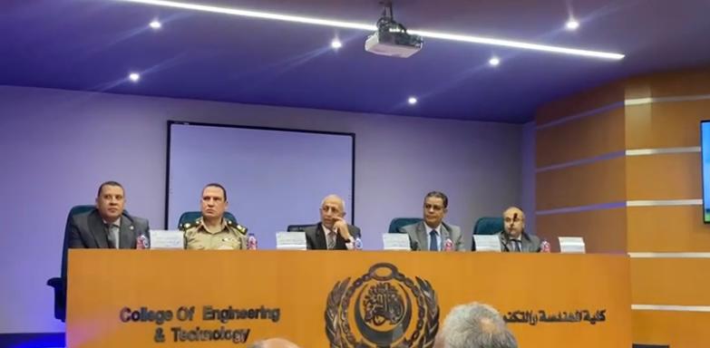
During the workshop activities, Dr. Mr. Hermas, Professor of the Department of Geomorphology, Department of Geological Applications at the Authority, the Authority’s capabilities and areas exposed to risks after construction and reconstruction without planning. Dr. also reviewed. Ashraf Helmy, Head of the Satellite Data Reception and Analysis Division at the Authority, applied artificial intelligence in remote sensing. Dr. Dalia El-Feki, summary of what took place in the CANSAT training workshop for academy students.
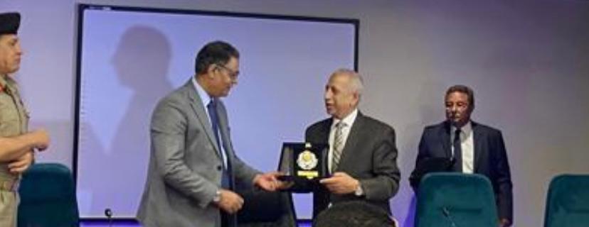
Dr. Ismail Abdel Ghaffar, President of the Arab Academy for Science, Technology and Maritime Transport, praised the effort and cooperation with the Authority, and presented a certificate of thanks and the Maritime Academy’s shield to the head of the Sensor Authority. Dr. Islam Abu Al-Majd was invited to join the Academy’s Industry Advisory Council, and the organizing committee presented certificates of thanks to the lecturers and workshop coordinators. From the sensor body.
The workshop witnessed the presence of Dr. Yasser Jalal, Dean of the College of Engineering and Technology, and Dr. Ali Amasha, Head of the Remote Sensing and Geographic Information Systems Unit at the Academy and General Coordinator of the workshop, Major General Mustafa Radwan, Director of the Military Survey Department, and Dr. Muhammad Muhanna, Dean of the Faculty of Engineering at Al-Azhar University, and Eng. Wissam Abdel Fattah, founder of Arj Yero, and Dr. Noha Al-Amiri, Vice Dean of the College of Engineering for Training and Community Service, and Dr. Sherif Fadel, Head of the Computer Department at the Academy.
Latest Events
Latest News
NARSS
National Authority for Remote Sensing & Space Sciences
NARSS is the pioneering Egyptian institution in the field of satellite remote sensing. NARSS is an outgrowth of a Remote Sensing Center, established in 1971 as an American-Egyptian joint project that was affiliated to the Egyptian Academy of Scientific Research and Technology


