Description
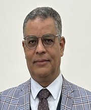
Prof. Dr. Islam Abou El-Magd
Education
PhD, School of Civil Engineering and The Environment, University of Southampton, UK
The thesis entitled “Improved image processing and geographic information systems techniques for improved water resources management” School of Civil Engineering and The Environment, University of Southampton (2004)
MSc, Faculty of Science, University of El-Mansoura, Egypt
The thesis entitled “Environmental studies on Lake Manzala, Egypt using remote sensing and geographic information systems” University of El-Mansoura, Egypt (1996)
Diploma: Faculty of Science, University of El-Mansoura, Egypt (1993)
BSc: “Special Geology” Faculty of Science, University of El-Mansoura, Egypt (1987)
Publications
1. Abou El-Magd et al., 2019 GHG Emissions Profile of the Arab Region and Potential for Mitigation, Chapter in UNHabitat Global report“
2. Abou El-Magd et al., 2019, تقرير حالة البيئة 2017 ملخص لواضعى السياسات
3. Li W., Ali EM., Abou El-Magd I., and El-Askary H., (2019) On the Synergy between a Multi-Sensor Approach and AERONET Data assessing Aerosol Characteristics and Variability over Cairo and the Greater Delta Region Egypt, Aerosol and Air Quality Research, Remote Sensing, 11, 1998; doi:10.3390/rs11171998 .
4. Abou El-Magd, I., Mohy, H. and Basta, F., and Amasha A., (2019), Utilization of full-polarimetric SAR data (RADARSAT-2), ASTER and Landsat 8 data in geological mapping of the west Gebal Elba area, Halayeb district, South Eastern Desert, Egypt, Journal of the Indian Society of Remote Sensing Journal of the Indian Society of Remote Sensing, https://doi.org/10.1007/s12524-018-0923-7.
5. Ali Amasha, Islam Abou El-Magd and Elham Ali (2019) Geospatial Auto-correlation Statistical Analysis to Evaluate the Seismic Magnitudes and Its Implications on the Mediterranean Coastal Zone of Egypt, Physical Science International Journal, Vol 20(3): 1-15, Article no.PSIJ.46208.
6. Abou El-Magd, I., Mohy, H., and Abdel-Hamid A., (2018) Show Cases of Polarimetric Radar data applications in geomorphology and InSAR data for land subsidence, In COSMO SkyMed for Cultural Heritage, Eds. Islam Abou El-Magd , Rosa Lasaponara, Claudio Margottini (editors), A special Workshop at: GeoMEast 2018 “Sustainable Civil Infrastructures” 24-28 November 2018, Mena House Hotel (Cairo – Egypt) Info: https://geomeast.org.
7. El-Kadi H., Abou El-Magd I., Abdel-Raouf O., and Ebrahem O., (2018) Integrating Geospatial and Geophysical Information for Mapping Groundwater Potential Zones – Case Study of Matrouh-Negilla Basin, North Western Coast, Egypt, International Journal of Scientific Research in Science, Engineering and Technology (IJSRSET) , Vol. 4 (10), PP. 298-305.
8. Abou El-Magd, I., (2018) Monitoring Dust Storms in Egypt from Space, In The Field, Blog online, https://www.inthefieldstories.net/
9. Abou El-Magd, I., (2018) Monitoring Urban Heat Islands in Cairo from Space, In The Field, Blog online, https://www.inthefieldstories.net/
10. Abdel-Hamid A., Dubovyk, O., Abou El-Magd, I, Menz, G. (2018) Mapping Mangroves Extents on the Red Sea Coastline in Egypt using Polarimetric SAR and High Resolution Optical Remote Sensing Data, Sustainability 2018, 10, 646; doi:10.3390/su10030646.
11. Abou El-Magd, I., Ali, EM and Amasha, A. (2018) Mapping of Geomorphological Features and Surface Sediments in Nekhel Area, Sinai Peninsula, Egypt Using Integration between Full-polarimetric SAR (RADARSAT-2) and Optical Remote Sensing Data, Journal of Geography, Environment and Earth Science International, 15(1): 1-12, 2018; Article no.JGEESI.41461 ISSN: 2454-7352.
12. Abdel-Hamid A., Dubovyk, O., Abou El-Magd, I, Menz, G. (2017) Integration of SAR and Optical Remote Sensing Data for Mapping of Mangroves Extents, Proceedings of EnviroInfo 2017, Luxembourg, September 2017.
13. Abou El-Magd, I. and Ali, EM (2017) Earth Observations for Egyptian Coastal Lakes Monitoring and Management, In: A.M. Negm et al. (eds.), Egyptian Coastal Lakes and Wetlands: Part II - Climate Change and Biodiversity, Hdb Env Chem, DOI 10.1007/698_2017_79, Springer International Publishing AG 2017.
14. Abou El-Magd, I. (2017) Earth observation activities and future perspectives in Egypt, the International Archives of the Photogrammetry, Remote Sensing and Spatial Information Sciences, ISPRS Journal – The archives of photogrammetry and remote sensing, Volume XLII-3/W2.
15. Abou El-Magd, I. and Ali, EM (2017) Geoinfrmatics and DPSIR framework for Sustainable Development of a Portion of the Red Sea South Western Coast, Egypt, Proceedings of the AARSE 2016 conference, Uganda.
16. Abou El-Magd, I. and Ali, EM (2016) Southern Mediterranean Basin: Environmental Challenges and Opportunities, Scholar Press, ISSN
17. Abou El-Magd, I. (2016) Overview of Global strategies in Education, Space, Science and Technology, Proceedings of the International Conference – Africa New Perspectives, Cairo University, 25-27 May 2016.
18. Abou El-Magd, I. (2016) Egypt Vision on the Implementation Mechanisms of the African Space Policy and Strategy, Proceedings of the International Conference – Africa New Perspectives, Cairo University, 25-27 May 2016.
19. Mikhaeil M., Corzo G., and Abou El-Magd I., (2016) Model based evaluation of structural measures impact on the inundation area of Wadi driven flash floods Case study of Wadi Dahab, Sinai Peninsula, Egypt. International Journal of Engineering Research and Management, 3 (8): 146-155.
20. Hussien ElKobtan, Mohamed Salem, Karima Attia, Sayed Ahmed and Islam Abou El-Magd (2016) Sedimentological study of Lake Nasser; Egypt, using integrated improved techniques of core sampling, X-ray diffraction and GIS platform, Cogent Geoscience, 2: 1168069, http://dx.doi.org/10.1080/23312041.2016.1168069
21. Ali, EM and Abou El-Magd, I. (2016) Impact of Human Interventions and Coastal Processes along the Nile Delta Coast, Egypt from the Past Twenty-Five Years, Egyptian Journal of Aquatic Research, 42, 1-10
22. Hussein M. El-Kobtan, Islam H. Abou El-Magd, Mohamed Salem, Karima M. Attia, Sayed M. Ahmed (2016) Estimating Simulation Models of Some Hydrographic Parameters along Lake Nasser, Egypt; Applying Integration between Remote Sensing and GIS Techniques, Journal of Remote Sensing Technology, 4 (1), 70-82
23. Abou El-Magd, I., Ahmed Ismail and Naglaa Zanaty (2016) Spatial Variability of Urban Heat Islands in Cairo City, Egypt using Time Series of Landsat Satellite Images, International Journal of Advanced Remote Sensing and GIS, 5 (3), 1618-1638.
24. Abou El-Magd, I., Mohy, H. and Basta, F (2016) Newly Improved Band Ratio of ASTER Data for Lithological Mapping of the Fawakhir Area, Central Eastern Desert, Egypt, international journal of the Indian society of remote sensing, DOI 10.1007/s12524-015-0539-0.
25. Abou El-Magd, I., Gheith, A. and Abouel Ela A., (2015) Human Impacts and Risks on the Northern Coastal Nile Delta Lagoons in the last 60 Years Using Remotely Sensed Data, Environmental Bulletin, Mansoura University Press. 26. Abou El-Magd, I. ; Hasan, A. and ElSayed, A. (2015) A Century of Urban Sprawl in Menofya Governorate, Egypt, Using Remote Sensing and Geographic Information Analysis, Journal of Geographic Information System, 2015, 7, 402-414 27. El-Gamily, H. , Al-Awadhi, N., Abou El-Magd, I. and Watkins, D. 2015. Kuwait Integrated Environmental Information Network (KIEIN-IV): a way of developing national environmental indicators for better environmental information dissemination, Journal of Spatial Science, http://dx.doi.org/10.1080/14498596.2015.1004655
28. Abou El-Magd, I. and Abdel Hamid A., (2015) Exploring the potentiality of polarimetric SAR remote sensing in ecological investigation, African Association of Remote Sensing and Environment,
29. Abou El-Magd, I., Ahmed Hasan2, Abdelfatah El Sayed (2015) A Century of Monitoring Urban Growth in Menofya Governorate, Egypt, Using Remote Sensing and Geographic Information Analysis, Journal of Geographic Information System, 7, 402-414
30. Abou El-Magd, I., Aziza Badr and Wael Metwaly (2015) Studying Urban Growth in Addis Ababa City, Ethiopia: Its trends, Problems, and Ways to control using remote sensing and GIS techniques, African Association of Remote sensing and the Environment.
31. Abou El-Magd, I., Mohy, H. and Basta, F. (2014) Application of remote sensing for gold exploration in the Fawakhir area, Central Eastern Desert of Egypt, Arab J Geosci, DOI 10.1007/s12517-014-1429-4
32. Abou El-Magd, I. and Alzaeny, A., (2014) Quantitative remote Quantitative hyperspectral analysis for characterization of the coastal water from Damietta to Port Said, Egypt, Egyptian Journal or Remote Sensing and Space Sciences.
33. Abou El-Magd, I.A., El Kafrawy, S. and Farag, I. (2014) Detecting Oil Spill Contamination Using Airborne Hyperspectral Data in the River Nile, Egypt. Open Journal of Marine Science, 4, 140-150. http://dx.doi.org/10.4236/ojms.2014.42014
34. Abou El-Magd and Ali, E.M. (2014) Short-Term Projection of Climate Changes in Sinai Peninsula, Egypt, International Journal of Sci., Tech. & Env., Volume 4, Issue 1.
35. Abou El-Magd, I., Hassan, O. and Arafat, S. (2013) Quantification of sand dune movements in the south western part of Egypt, using remotely sensed data and GIS, International Journal of Geographic Information System, 5(5)
36. El-Gamily, H., Al-Awadhi, N., Abou El-Magd, I. And Watkins, D. (2013) “Kuwait Integrated Environmental Information Network: Way of Developing National Environmental Indicators for Better Environmental Information Dissemination”, Proceeding of HIMA conference, Kuwait.
37. Hermas, E.A., Leprince, S. & Abou El-Magd, I., (2012) Retrieving sand dune movements using sub-pixel correlation of multi-temporal optical remote sensing imagery, northwest Sinai Peninsula, Egypt, Remote Sensing of Environment, 121, 51-60.
38. Abdel Kawy, W & Abou El-Magd, I. (2012) “Use of satellite data and GIS for assessing the agricultural potentiality of the soils South Farafra Oasis, Western Desert, Egypt, Arabian Journal of Geosciences, DOI 10.1007/s12517-012-0518-5.
39. Abdel Kawy, W & Abou El-Magd, I. (2012) “Assessing the agricultural potentiality of some soils south el farafra oasis, western desert, Egypt, Arabian Journal of Geosciences, DOI 10.1007/s12517-012-0519-4.
40. Abou El-Magd, I. & Ali, E.M. (2011) "Near real-time estimation of the evaporative losses from lake Nasser, Egypt using optical satellite imagery, International Journal of Digital Earth, DOI: 10.1080/17538947.2011.586442, 1- 14.
41. Abou El-Magd, I., Hermas E.A. and El Bastawesy, M. (2010) GIS-modelling of the spatial variability of flash flood hazard in Abu Dabbab catchment, Red Sea Region, Egypt, Egyptian Journal of Remote Sensing,13,81-88. doi:10.1016/j.ejrs.2010.07.010
42. Abou El-Magd, I. & Hermas, E.A. (2010) Human Impact On The Coastal Landforms In The Area Between Gamasa And Kitchner Drains, Northern Nile Delta, Egypt, Journal of Coastal Research,26(3).
43. Hermas, E.A., Abou El-Magd, I. & Saleh, A.S., (2010) Monitoring lateral channel movements on the alluvial 1 fan of Wadi Feiran drainage basin, South Sinai, Egypt using multi-temporal satellite imagery. African Journal of Earth Sciences,
doi:10.1016/j.jafrearsci.2010.02.001
44. Ahmed, M.H., Ali, E.M. and Abou El-Magd, I., (2009) Detection of temporal changes in coral reefs at Hurghada (Red Sea, Egypt) and environmental factors controlling deteriorated sites using landsat and field data. Egyptian Journal of Aquatic Biology and Fisheries, 13 (4), 403-419.
45. Abou El-Magd, I., (2009) Estimation of the Spatial Distribution of Crop Coefficient (Kc) from Landsat Satellite imagery , Egyptian Journal of Remote Sensing, 12, 43-54.
46. Abou El-Magd, I, & Hillman P., (2009) Geomorphological Monitoring of Highly Dynamic Estuary Using Oblique Aerial Photographs, International Journal of Digital Earth, 2(2), 109-121.
47. Altay, G., Ersoy, O., Abdel Wahab, M., El-Afandi, G., Shokr, M., El-Ghazawi, T., Mohamed, M.A, Eleithy, B., Abou El-Magd, I., Biehl, L., Grant, D. and Rochon, G. (2009) Deployment of Real-time Satellite Remote Sensing Infrastructure to Support Disaster Mitigation: A NATO Science for Peace Collaboration with Research Universities in Turkey, Egypt and the USA, Turkish air force academy-aeronautics and space technologies institute, Proceedings of the 4th International conference on recent advances in space technologies
48. Abou El-Magd, I A, & Ali, E.M. (2008) Estimating and Mapping Chlorophyll a Concentration as a Function of Environmental Changes of Manzala Lagoon, Egypt using Landsat 7 ETM+ Images. Australian Journal of Basic and Applied Sciences 2(4), 1307-1314.
49. Abou El-Magd, I.A., Hermas, E.A. and El-Helow, M. (2008) GIS modelling for strategic planning of regional ring road, Cairo, Egypt. Proceedings of the 7th ARRSE conference, Accra, Ghana.
50. Hermas, E.A., Abou El-Magd, I. & Cherief Omar (2008) assessment of flash flood potential of Abu Dabbab drainage basin, the red sea region, Egypt. Proceedings of the 7th ARRSE conference, Accra, Ghana
51. Abou El-Magd, I. & Faid, A. (2007) Hydrogeological and Environmental Studies on Siwa Oasis, Egypt Using GIS Technique. Egyptian Journal of Soil Sciences, 47(4), 435-450.
52. El-Magd, I A., et al., (2006): Phase III Environmental Impact Assessment of the Mersey Crossing, Halton Borough Council, UK, Internal Report.
53. El-Magd, I A., et al., (2006): Phase II Environmental Impact Assessment of the Watford Health Campus for the Redevelopment and Masterplanning of Watford General Hospital, Watford Borough Council, UK, Internal Report.
54. El-Magd, I A and Tanton, T (2005) Remote sensing and GIS for estimation of irrigation crop water demand, International Journal of Remote Sensing, Volume: 26 (11).
55. El-Magd, I A and German, S (2005) Access-Geodatabase Modelling to Aid Decision Making in River Restoration: Case Study River Beult, Kent, UK, Proceedings of the 19th International Conference Informatics for Environmental Protection (EnviroInfo 2005), Brno, Czech Republic
56. El-Magd, I A., (2004) Real-time crop coefficient from SEBAL method for estimating the evapotranspiration, Proceedings of SPIE Volume: 5232, Remote Sensing for Agriculture, Ecosystems, and Hydrology V.
57. El-Magd, I A and Tanton, T (2003) Improvements in Land Use Mapping for Irrigated Agriculture from satellite Data Using a Multi Stage Maximum Likelihood Classification, International Journal of Remote Sensing, Vol., 24 (21).
58. El-Magd, I A and Tanton, T (2003) GIS Modelling for Irrigation Water Scheduling. Proceedings of the GIS Research UK, GISRUK2003, City University, April 2003
59. El-Magd, I.A., (2003) Water resources management and planning; the need for multidisciplinary modelling approaches. IUGG 2003 Scientific Forum, 23rd General Assembly of IUGG and 32nd General Assembly of IASPEI Sapporo, Japan 30 June – 11 July 2003
60. El-Magd, I A and Tanton, T (2002) Remote Sensing and GIS for Irrigation Water Planning. Proceedings of the GIS Research UK 10th Annual Conference GISRUK2002, Sheffield University.
61. El-Magd, I A., (2001) Remote Sensing and GIS Application for Monitoring the Environmental Changes and Water Quality; Case Study of Lake Manzala, Egypt. Proceedings of the GIS Research UK, 9th Annual Conference GISRUK2001, University of Glamorgan.
62. Abdel-Kader, A F, El-Magd, I A, and Hegab, O. A., (1999) Using Remote Sensing and Geographic Information Systems in the Environmental Assessment of Lake Manzala, Egypt. African Journal of Environmental Assessment and Management (AJEAM), Vol 1(2).
63. Abdel-Kader, AF and El-Magd, I A., (1998) Environmental Assessment of Lake Manzala Using Remote Sensing and GIS. National Forum on Support of Remote Sensing Techniques to Planning and Decision Making Processes for Sustainable Development in Egypt; Cairo, Egypt, 8 March 1998. MAP/UNDP, CTM-RAC/ERS.
